New perspectives from the air: Using drones for environmental and heritage site assessments
Author: Luke Baker, Executive General Manager – Operations
May 12, 2025
News & Insights
Using drones for environmental and heritage site assessments
Visiting and surveying sites in person is an integral part of our heritage, ecology and natural capital work—but there are also some ways technology can assist the process and create significant benefits for our clients. Drones, for example, can provide imagery of a site at scale and speed, helping us survey and assess sites in a more efficient and accurate way.
Luke Baker, Executive General Manager – Operations, explores some of the ways our Ecology and Heritage teams are using drones in our work.
Efficiency and scale benefits
There are many ways drones can support our work, from the very start of a project to get a sense of the task at hand, to conduct surveys and capture data, through to ongoing monitoring of sites.
Drone-mounted cameras can help survey large areas much more quickly and cost-effectively than we could get across a site on foot. They are also invaluable for capturing detail with accuracy and reaching difficult locations to get the best picture of a site.
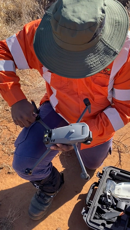
Niche expert preparing a drone for a field survey
Koala spotting by night
Identifying the presence of koalas across a large site, can be a lengthy and cost-intensive process.
Using thermal detection to spot koalas by their heat signatures can be far more effective than using traditional survey methods like spotlighting. By using drones with thermal sensors, we can spot koalas in remote terrain that would be difficult and unsafe to traverse, especially at night.
On a recent project, our ecologists deployed thermal drones to search for koalas on a 200-hectare biodiversity stewardship site in NSW. With one of our ecologists who is a licensed pilot flying a drone, the survey was completed in 16 hours. Based on approved survey guidelines, this same survey work conducted using the spotlighting method would have taken 53 hours.
While this is already an impressive demonstration of how drones can streamline our work, even greater efficiencies can be achieved by flying drones beyond the line of sight. This is more advanced and requires additional training, but can be a great option for some projects.
While the suitability of drones for koala surveys does vary across sites and locations, our team are excited by the opportunities for using drones to drive efficient results for our client’s projects.
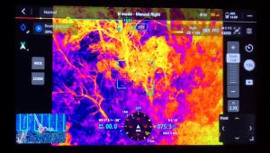
Our team identify a koala using thermal drone during a survey
Preserving history with the help of technology
Drones also support heritage management work and are often used for projects such as building surveys, site inspections, archival recordings and archaeological digs.
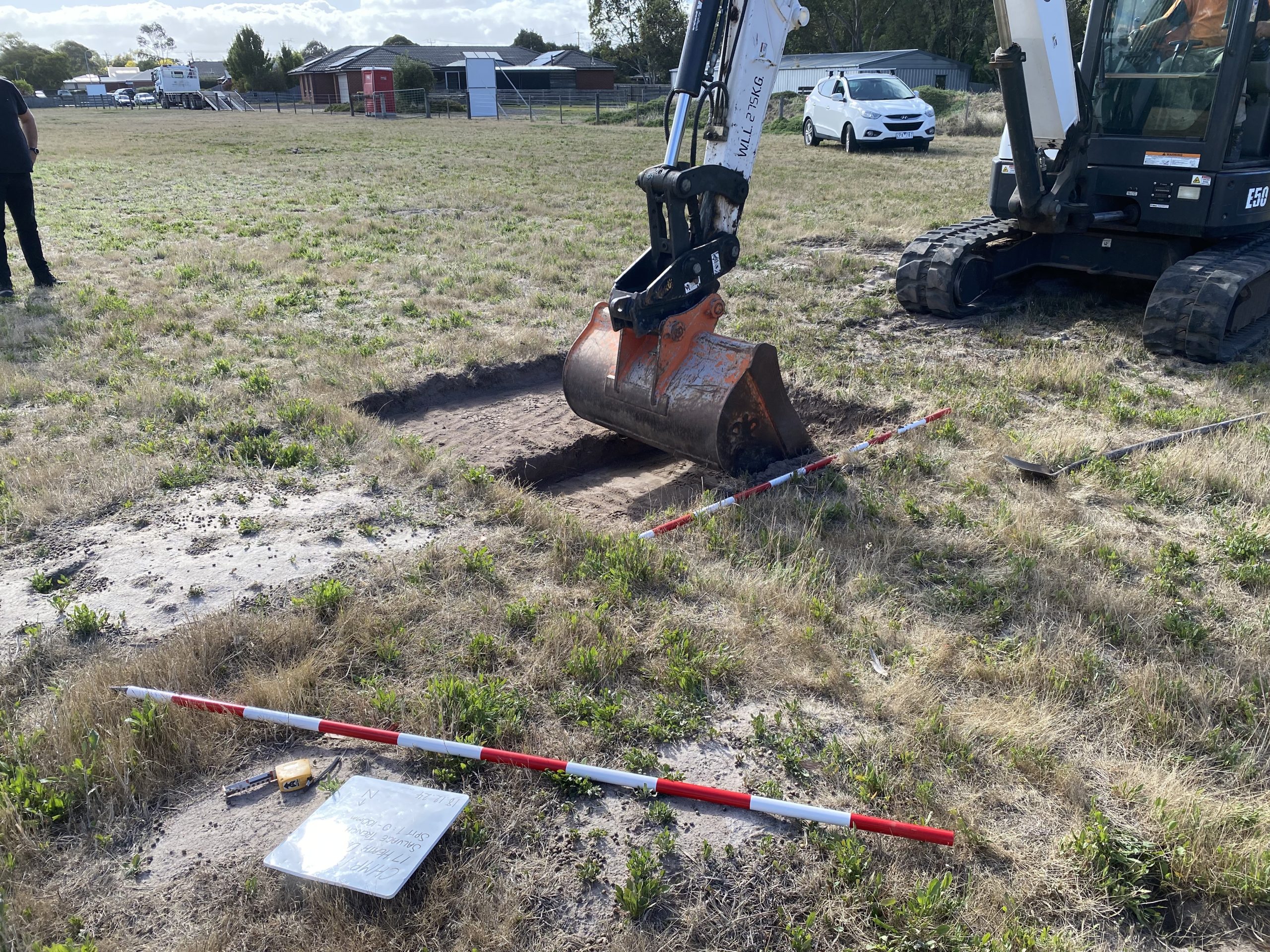
On a current project in NSW, our team has used a drone-mounted camera to capture footage of the site where we are conducting an archaeological test excavation to identify deposits near a State Significant heritage site.
In this instance, the drone survey let the team collate a clear picture of the site’s landscape, boundaries and testing locations before and during the excavation—resulting in a more efficient project for our client.
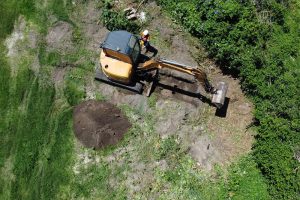
Drone photo of a heritage site excavation
Specialty skills and training required
While the technology is certainly making it easier to get an overview of a site, drone surveying involves considerable human expertise and input.
Drone usage is closely monitored by the Civil Aviation Safety Authority (CASA) and pilots must complete a CASA Operators Accreditation. To fly drones at night, for example to conduct koala thermal surveys, pilots must also have a Remote Pilot Licence (RePL), and the organisation must hold a Remotely Piloted Aircraft Operator’s Certificate (ReOC). For work that requires flying drones beyond line of sight, additional qualifications and flight permissions are required by CASA.
The knowledge and experience of skilled ecology and heritage specialists is also essential for planning and executing surveys to know where and when to look, how to safely navigate the terrain and how to document the findings.
New perspectives
We cannot see a time when we will not need to get out on the ground and walk a site. But using the latest technology offers important benefits for both project proponents and landholder clients and helps improve environmental conservation and heritage protection outcomes for projects.
For more information, please get in touch with us today.